Palm Beach County Safety and Growth Enforcement (S.A.G.E.) is a project of Protect American Values Action, Inc., a 501(c)(4) public policy organization. Palm Beach S.A.G.E. advocates for the interests of all Palm Beach County residents, and especially the families and neighbors who call the Agricultural Reserve home. This grassroots coalition is seeking to protect the Agricultural Reserve for a stronger tomorrow.
Property Map & Documents
Islamic Center & Surrounding Area · West Delray Beach, Florida
Geographic Reference ·
Islamic Center & Surrounding Area
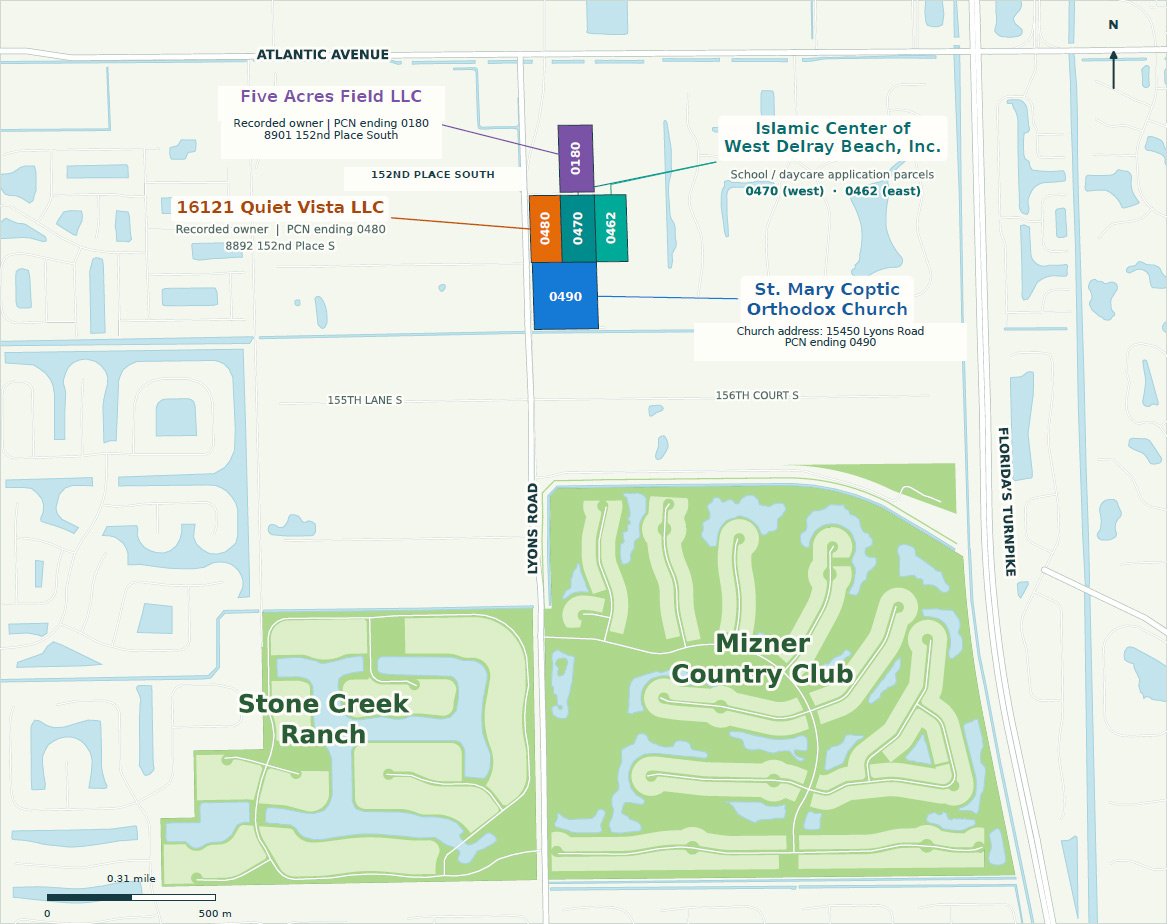
Map Notes
- 0480 adjoins 0470; 0470 adjoins 0462. 0480 does not adjoin 0462. Thin dark lines are shared boundaries, not gaps.
- 0180 is across 152nd Place South. GIS road-corridor geometry does not determine fee ownership or easement rights.
- The 2023 school report refers to a property line extending to the easement centerline; survey/title review is required.
- Nearby communities are geographic context only. School/daycare labels identify application parcels, not verified operation.
- Current owners checked 21 October 2026. Project parcel geometry: Palm Beach County parcel GIS. Original contextual basemap retained.
- GIS reference, not a boundary survey.
Parcel References & Sources
- 0180
- 00424620010000180
- 0470
- 00424620010000470
- 0462
- 00424620010000462
- 0480
- 00424620010000480
- 0490
- 00424620010000490
Sources listed in the supplied map: gis.pbcgov.org; pbcpao.gov; PBC July 6, 2023 school zoning report, pp. 2–3.